The Hidden Twisties: Ohio’s Covered Bridge Scenic Byway (SR 26)

There is a distinct difference between hitting the highway for a quick interstate cruise and intentionally seeking out the forgotten, undulating ribs of the Appalachian foothills. If you are the kind of rider who judges the quality of a weekend by the amount of edge-wear on your tread, Southeast Ohio is your holy grail.
While the state has its famous asphalt heavyweights, State Route 26—also known as the National Forest Covered Bridge Scenic Byway—presents a masterclass in rhythm, technical elevation, and raw, old-school Americana. Running roughly parallel to the path of the Little Muskingum River, this route treats you to a landscape where modern distractions drop away, replaced by sweeping canopy tunnels and historic engineering landmarks.
For those of us balancing hectic work schedules, family commitments, or just looking to squeeze every drop of value out of a rare, clear weekend, Route 26 delivers the ultimate reset.
Here is what you need to know to tackle this classic stretch of Ohio asphalt.
Quick-Reference Ride Logistics
-
Total Distance: Approximately 67 miles (one-way from Marietta to Woodsfield).
-
Best Time to Ride: Late spring through early autumn. Mid-week mornings offer completely empty pavement, but crisp weekend mornings in June or July are hard to beat.
-
Primary Hazard: Blind hill crests, tight switchbacks with occasional mid-corner gravel washout from rural drives, and slow-moving farm equipment or wild deer popping out of the Wayne National Forest.
What makes State Route 26 an essential ride?
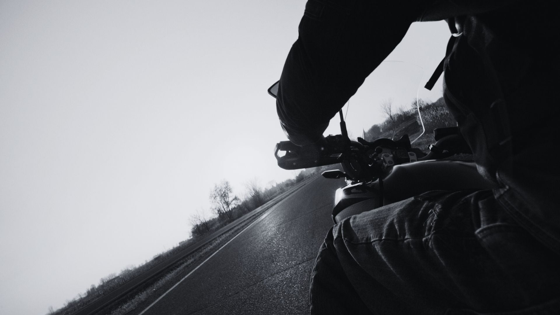
State Route 26 stands out because it combines tight, highly technical technical switchbacks with long, sweeping valley floors that let the bike breathe. Unlike flat, straight commuter roads, this byway demands your full focus as it climbs ridges and drops into narrow river hollows, making it an incredibly rewarding challenge for any experienced road rider.
The asphalt itself is the star of the show. Starting out from the historic river town of Marietta, the road introduces itself gently with wide, sweeping bends. But do not let it fool you. As you push deeper into the boundaries of the Wayne National Forest, the lane markers begin to twist violently.
You will face hairpins that require precise cornering lines, sudden crests that will lighten your suspension, and drop-offs that offer incredible panoramic views of the valley if you have the spare focus to look. It is an active, physical ride that rewards smooth throttle control and proper body English, regardless of whether you are piloting a lightweight sport-tourer, a heavy cruiser, or a wide adventure rig.
Where are the best places to stop for food and lodging?
Because this route carves through a highly remote, preserved section of the Appalachian foothills, major commercial centers are nonexistent once you leave the terminal towns. Planning your fuel, food, and rest stops is essential to keeping the ride seamless.
Best Places to Eat
-
The Levee House Bistro (Marietta, OH): Located right on the Ohio River at the southern launch point of your trip, this spot is perfect for a high-quality, hearty meal before you throw a leg over the saddle. The paved parking area nearby makes staging a group easy.
-
The Historic Beallsville Diner (Beallsville, OH): Located just a short, scenic jog past the northern end of Route 26, this classic small-town diner is highly popular among regional motorcycle groups. It is an unpretentious, rider-friendly staple serving up massive comfort-food platters, fresh local pizzas, and homemade pies that hit the spot after a morning of heavy cornering.
-
Traditions Restaurant (Woodsfield, OH): Located right at 113 South Main Street, this independent, family-owned gem has been a community pillar for over two decades. Everything here is fiercely local—the owner hand-slices and marinades all their fresh ribeyes, pork chops, and chicken daily, and uses old family recipes for their scratch-made soups, dressings, and breads. It’s an incredibly welcoming, unpretentious spot for a real mid-day meal before you tackle the return twisties.
Recommended Lodging
-
The Lafayette Hotel (Marietta, OH): A legendary, historic riverboat-era hotel situated right at the confluence of the Ohio and Muskingum rivers. It features a distinct, old-world aesthetic, an onsite pub for post-ride wind-downs, and excellent proximity to the start of Route 26.
-
The Wisteria Inn (Woodsfield, OH): Nestled on a quiet corner right in the heart of Woodsfield at the northern end of the byway, this boutique property blends historic charm with modern comfort. It offers peaceful, secure grounds, a spacious carriage drive, and an incredibly hospitable atmosphere for long-distance touring riders who want to avoid generic highway motels.
How do you navigate the historic covered bridges safely?
The historic covered bridges on this route are fully accessible via short, clearly marked gravel pull-outs right off State Route 26. While most of these structural landmarks are preserved for foot traffic or limited local use, their staging areas provide flat, solid parking opportunities to drop the kickstand, stretch your legs, and take in the architecture.
As you navigate the byway, you will see signs pointing out iconic structures like the Rinard Covered Bridge and the Hune Covered Bridge. These hand-built treasures from the late 1800s are magnificent examples of historical engineering, but they do require a little riding strategy to access safely.
When you pull off the main asphalt to view them, be prepared for transitional surfaces. The transition from hot, sticky road asphalt to loose river gravel on the pull-outs can upset a heavy touring chassis if you enter too hot. Keep your eyes up, avoid stabbing the front brake on the loose stones, and let the machine roll smoothly into the parking spots.
Rider Tip: Keep an eye out for local signage regarding park maintenance. For instance, sections near the Hune Covered Bridge campground can occasionally experience local trail adjustments due to natural hillside slippage along the river bank. The main asphalt on Route 26 stays clear, but checking local forest service updates before a major trip is always a smart play.
What are the main road hazards to look out for on Route 26?
The primary hazards on State Route 26 are blind hill crests that hide slow-moving agricultural vehicles, coupled with loose gravel washed onto the road from steep gravel driveways after summer rainstorms. Because the road hugs the hillsides tightly, visibility into the meat of a turn can be limited, requiring conservative cornering entry speeds.
My husband has ridden on two wheels for more than forty years, and if there is one thing we always agree on when tackling Southeast Ohio backroads, it’s that these hills demand respect. You cannot ride Route 26 with a lazy mindset.
Because the asphalt cuts directly through working rural country, local tractors, trucks hauling livestock, and horse-drawn buggies use these lanes daily. Coming over a sharp, blind knoll at speed only to find a hay wagon moving at five miles per hour in your lane will test your emergency braking limits instantly. Keep your track central, manage your sightlines, and never cook into an apex faster than your stopping visibility allows.
Furthermore, the dense tree canopy inside the Wayne National Forest creates beautiful shade, but it also hides damp patches on the asphalt hours after a morning rain has cleared. Watch out for slick fallen leaves on the outer shoulder and micro-layers of morning condensation in the deep, low-lying valleys.
Is State Route 26 friendly for wide touring bikes and trikes?
Yes, State Route 26 features fully paved lanes that easily accommodate large cruiser platforms, adventure touring bikes, and wider three-wheel configurations. The lane widths are standard and consistent, though riders operating wider track setups must stay highly disciplined with their lane positioning through the tightest switchbacks.
If you are tracking on three wheels or pulling a small cargo trailer behind a touring rig, this road is an absolute blast, but it will work your steering muscles. Because a trike cannot lean into a turn to cut a narrow profile, you must be hyper-aware of your outside fender width when hugging the white line on a tight right-hander. Conversely, on sharp left-handers, ensure your head and torso do not cross the yellow center line as you steer through the arc.
The pull-outs at the scenic historic bridges are broad, flat, and level, meaning you do not have to worry about finding an elusive piece of perfectly level asphalt to park a heavy machine safely. It offers all the isolation and thrill of a remote backcountry escape, with the security of solid, well-maintained pavement under your tires from start to finish.
Pack your gear, clear your schedule for the day, and go see a part of Ohio that modern highways completely left behind.